

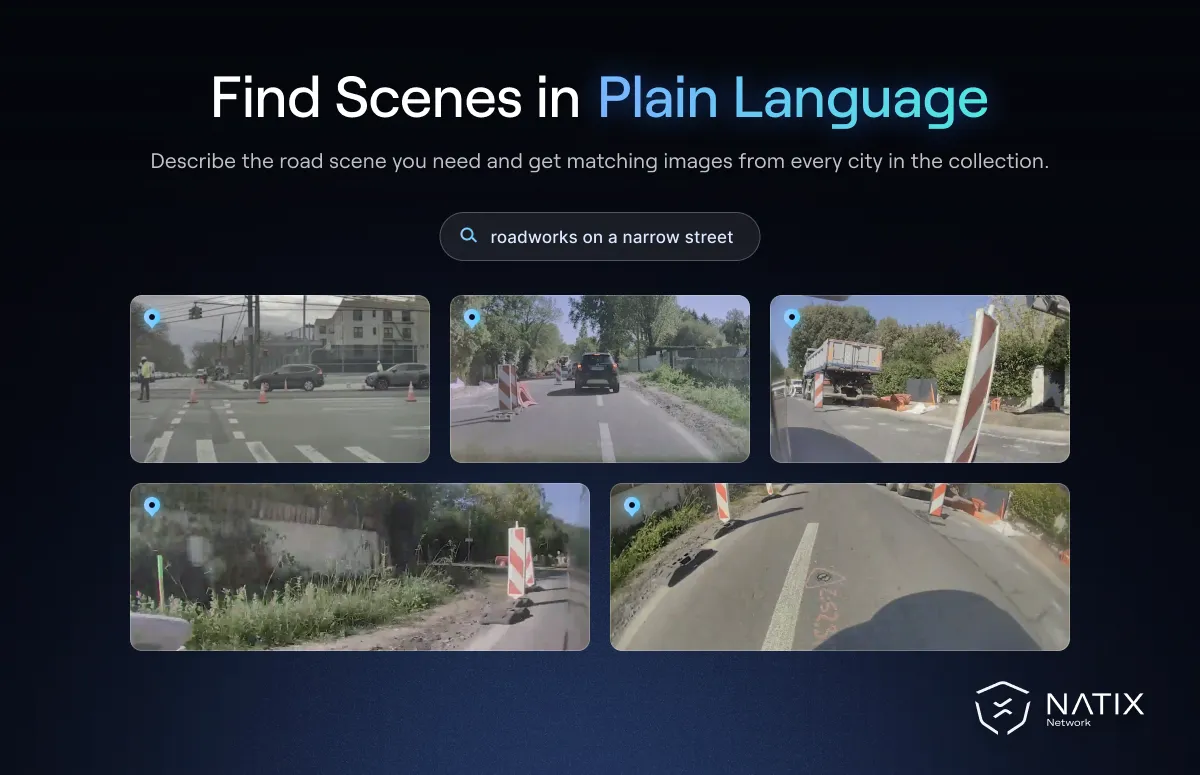
Street level imagery is the visual record of roads as a driver or pedestrian sees them. It shows storefronts, signs, lanes, junctions and the people and vehicles moving through them. It has long powered maps, navigation and city planning. Now it is becoming a source of training and test data for driving systems. The bottleneck has shifted from collecting images to finding the right ones.
Natural-language search is changing that. Instead of browsing by location, teams can describe the scene they need and retrieve every matching image across many cities.
Street level imagery is captured from ground level, usually by cameras on vehicles. Its main users include:
For autonomous driving and mapping teams, it serves a slightly different purpose. They need examples of particular road layouts, signs and conditions to train and test perception and planning systems. A team building lane detection for a new market, for instance, needs many images of that market's specific lane markings in different light and weather.
Traditional street view search works by place. You pick a location on a map and see the images captured there. That is useful when you know where something is. It is much less useful when you know what you need but not where to find it.
Driving teams usually know what. They want unprotected left turns with oncoming buses, or school zones with temporary signs, or roads where snow covers the lane markings. Those scenes are scattered across thousands of locations, and no one can browse their way to all of them. Location-based search simply does not match the question being asked.
Vision-language models make a different kind of search possible. These models connect what is in an image with how people describe it. As a result, a written query can retrieve matching scenes regardless of where they were captured. A query such as "construction zone with a flagger at dusk" can return examples from many cities at once.
This is a form of spatial intelligence, the ability of a system to reason about what is where in the physical world. Combined with location data, it lets teams ask questions that blend both: "this type of junction, but only in cities where we plan to launch". That launch area is what engineers call the operational design domain, and searchable imagery makes its coverage much easier to check.

Plain-language search also changes who can use the data. An engineer no longer needs to write a custom filter or know the exact coordinates of a scene. They can describe it, check a sample of the results, and refine the description until the matches are right. That makes it practical to build focused test sets in hours rather than weeks.
NATIX built this capability into WorldSeek, a platform that makes street level imagery searchable through natural-language queries. As we described when introducing WorldSeek, users can search for scenes by describing conditions such as weather, road features or driving situations. The work builds on NATIX's mapping collaboration with Grab, covered in our announcement of the NATIX and Grab partnership.
For mapping teams, that means finding road features without combing through location after location. For driving teams, it means retrieving specific scene types to train or test against, a key step in scenario mining for the long tail.
Street level imagery captures people, vehicles and homes, so searchability raises fair questions about privacy. The more powerful the search, the more important it is that personal details are removed before the data is used. Faces and license plates should be blurred, and queries should focus on road scenes rather than on individuals.
In NATIX's collection, faces and license plates are blurred, where technically feasible, before footage is made available for use, as set out in our privacy notice. That keeps the focus where driving and mapping teams need it: on lanes, signs, junctions and the behavior of traffic as a whole. Responsible handling is not only an ethical requirement. It is also what makes it possible for companies to adopt the data with confidence and keep using it over time.
Still images and driving video serve different needs, and the best workflows use both. Street level imagery is ideal for questions about places and static features: signs, road layouts, lane markings and roadside objects. Driving video adds motion, showing how other road users behave and how scenes change over seconds.
A practical pattern is to use image search to locate the places and conditions that matter. Teams then pull the matching stretches of multi-camera driving video for training and testing. Used together, the two give both the static detail of a place and the motion of the traffic moving through it. Teams that need that second step can draw on large collections of real-world driving data recorded by everyday drivers.
Street level imagery has always shown what the world looks like. Plain-language search finally makes it possible to find the exact parts of that world a driving system still needs to learn.


