


A self-driving car that performs flawlessly in Phoenix can stop working in Mumbai. Not because the software is broken, and not because the sensors fail, but because the world looks different there. The roads are different. The signage is different. The way people merge, signal, and resolve right-of-way is different. The weather is different. And the model behind the car has never seen any of it.
This is the part of autonomy that the industry rarely talks about directly. The race is usually described as a contest between algorithms, sensor stacks, or compute budgets. In practice, the bottleneck sits somewhere else. Autonomous driving is constrained, more than anything, by the geography of its data. A self-driving system can only generalize as far as the world it has experienced. And no model, no matter how sophisticated, can compensate for places it has never seen.
The common thread is clear: autonomy is a data problem, and the shape of that data is determined by geography. Companies that have driven a few cities thousands of times have built impressive demos. Companies that need to operate across many cities, climates, and driving cultures are running into a much harder problem. The work is not finished once the model is trained. It is finished only when the model has seen enough of the world to behave reasonably in places it has never been before.
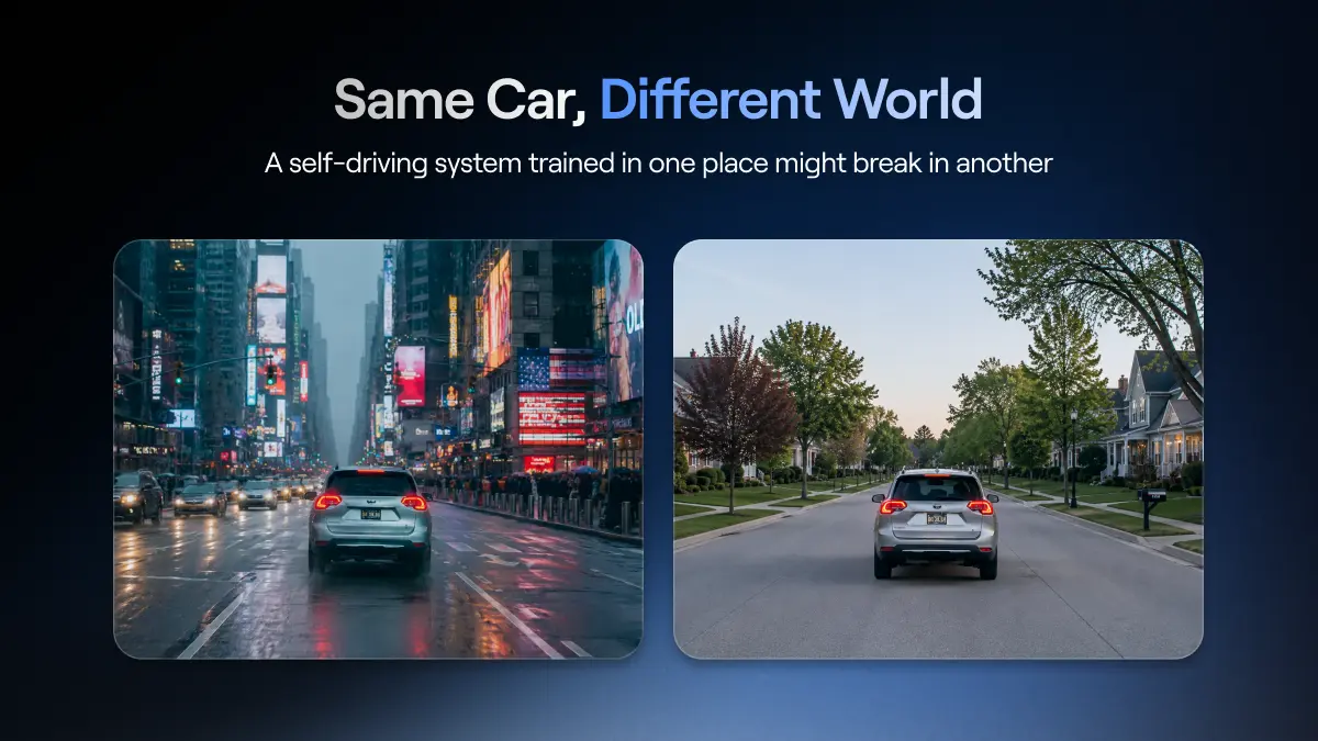
Driving is local in ways that most autonomy discussions underestimate. Lane width, turn radius, intersection design, road condition, traffic density, and how pedestrians and cyclists behave all vary across regions. Signage is even less consistent. Speed limits are expressed differently. Road markings fade in some climates faster than in others. Stop lines are painted in one country and implied in another. Roundabouts have different right-of-way conventions across borders.
Driving culture matters even more. In some cities, a horn means warning. In others, it means presence. In some places, drivers expect eye contact at intersections. In others, motorcycles weave between lanes as a normal pattern of flow. None of this shows up in a map. It shows up in the way the world unfolds in front of the camera, which is exactly what a self-driving system has to learn to understand.
A model trained on data from a small set of cities will be confident in those cities and uncertain everywhere else. That uncertainty is not just a matter of accuracy. It is a matter of safety, because the rare events that determine whether a system is safe are exactly the events that are most strongly shaped by local conditions.
The industry has a term for the boundary of where a self-driving system is allowed to operate. It is called the Operational Design Domain (ODD). An ODD specifies the roads, weather, time of day, and other conditions under which a system is considered safe. Outside that boundary, the system is not supposed to drive.
ODDs are useful as a safety mechanism. They are also a symptom of the geography problem. When a robotaxi service operates only in select neighborhoods of a few cities, the ODD is not just a technical constraint. It is an honest admission that the system does not yet generalize. The model has been trained on a specific slice of the world, and outside that slice, its behavior is not trusted.
This is why robotaxi expansion looks the way it does. Services come online in one city after another rather than rolling out across regions. Each new city requires fresh data, fresh tuning, and often fresh maps. The ODD grows slowly, because the underlying model only sees the world it has been shown.
The dominant response to the geography problem has been to push survey fleets into new cities and gather data there. Dedicated survey fleets drive specific routes, capture imagery, build high-definition maps, and feed that data back into the training and operations pipeline. It works, in a limited way. It does not scale.
The math is unforgiving. There are tens of thousands of cities and towns where self-driving systems will eventually need to operate. Each one has its own road network, traffic patterns, and edge cases. Sending a dedicated fleet into every one of them, on a regular cadence, would consume budgets that even the largest companies cannot sustain. Worse, the data collected this way tends to look the same across cities. The fleets drive at predictable times, on predictable routes, in predictable conditions. The more efficient the collection becomes, the more average the dataset tends to look.
That is the central tension of city-by-city collection. It is expensive enough to limit coverage, and structured enough to miss the rare events that matter most. Real geography includes night driving in heavy rain, narrow streets in old cities, construction zones that change weekly, and informal driving behavior at the edge of formal rules. None of that is captured well by a fleet on a fixed schedule.

Most of the work in autonomy is not solving the common case. The common case has been largely solved. A well-trained model can handle straight roads, clear weather, and orderly traffic with high reliability. What separates a demo from a deployable system is performance on rare events: the unusual intersection, the unexpected pedestrian, the strange vehicle, the unfamiliar road geometry. These are the edge cases, and together they form the long tail of driving.
The kitchen analogy is useful here. If a kitchen only practices making the top five dishes, the first time a customer asks for something unusual, everything falls apart. Self-driving systems trained on a narrow geographic slice are in the same position. They look fluent until the world hands them something they have not seen.
What makes the long tail hard is that it is distributed unevenly across the planet. A scenario that is rare in California may be routine in Bangkok. A weather pattern that is uncommon in Texas may dominate driving conditions in northern Europe. A road type that appears once in a thousand miles in one country may appear every few blocks in another. The long tail is not a single tail. It is many tails, layered on top of each other, and each one is shaped by where you happen to be driving.
This is the reason geographic diversity matters so much in autonomous driving data. It is not about novelty for its own sake. It is about compressing the long tail by giving the model exposure to events that are unevenly distributed across the world.
The industry has been moving steadily toward vision-only, mapless autonomy. Camera-only stacks remove the dependency on pre-built high-definition maps and expensive sensor combinations. They are cheaper, simpler, and more scalable. They are also more demanding in one important way. A camera-only system has to learn to read the world directly, without the crutch of a pre-loaded map telling it where lanes, signs, and intersections are supposed to be.
That means a vision-only system has to be trained on a much wider visual range. It has to see different lighting, different road materials, different sign shapes, different weather, and different traffic patterns. It has to learn what an intersection looks like in many countries, not just the ones where the engineers happen to live. The shift to vision-only does not solve the geography problem. It raises the bar on it.
This is why end-to-end learning and vision-first stacks are pushing companies harder into the question of where their training data actually comes from. Without geographic diversity in the dataset, a vision-only system will be confident on the roads it has seen and brittle everywhere else. The economics of vision-only are clean. The data requirement behind them is anything but.
There is a reasonable counterargument to all of this. If real-world geographic coverage is hard, why not generate it? Synthetic data, world models, and scenario generation can produce enormous volumes of training material at a fraction of the cost of real-world collection.
This is true, and it is one of the most important shifts in the field. World Foundation Models learn how scenes evolve and can generate physically coherent variations of rare events. Scenario generation takes real clips and produces many useful variants of them for simulation and training. Synthetic data is excellent for coverage. It is one of the few tools that can amplify the long tail at meaningful scale.
But synthetic data has a limit. It reflects the assumptions of the system that produced it. If a world model has never seen a roundabout in Cairo, it cannot generate plausible variations of one. If it has never seen monsoon driving in Mumbai, the synthetic versions it produces will not capture the way water, light, and traffic actually interact there. Synthetic data expands what is already known. It does not invent what has never been observed.
This is the training and validation distinction in practice. Training benefits from amplification. Validation depends on fidelity. For training, synthetic data multiplies the long tail. For validation, real-world data is the only honest reference. A system can be safe in simulation and still fail in reality if the simulation never saw the world the system has to drive in. Geography is the input that keeps the loop honest.

This is where NATIX matters. The geography problem cannot be solved by any single fleet, no matter how large. It can only be solved by a data layer that spans many countries, many cities, and many driving cultures, captured by drivers who actually live and move through those places.
NATIX builds that layer. The VX360 is a device that connects to vehicles with multi-camera systems by drivers across a global network. Each contributor captures the streets they already drive, in the conditions they already encounter, in the cities they already know. The result is multi-camera, surround-view data across geographies that no dedicated fleet would ever reach economically. It is not collected on a schedule. It is collected as drivers live.
That is why partners building global-scale autonomy systems have started to depend on this layer. The NATIX partnership with Grab brings street-level coverage across Southeast Asia, including cities and road conditions that almost no Western dataset represents well. The multi-camera World Foundation Model with Valeo uses this data to train and validate models that need to generalize across real-world variation, not just inside a single city's geofence.
NATIX is not building a self-driving system. It is building the global data substrate that other self-driving systems will need in order to actually work outside the places they were born.
The autonomous driving race is often described as a competition between models, sensors, and compute budgets. Those things matter. But the deeper bottleneck is simpler and harder to fix. A model can only learn what it has seen. And what it has seen is shaped, almost entirely, by where its data came from.
Cities are not interchangeable. Driving cultures are not interchangeable. Weather, road design, signage, and traffic behavior are local, and the long tail of edge cases is distributed unevenly across the planet. No algorithm closes that gap on its own. What closes it is data, gathered from many places, captured by many cameras, reflecting the world as it actually is.
In the end, autonomy is not about solving the average case. It is about building systems that remain stable when the world stops behaving predictably. The companies that see the most of the world will be the ones that can teach machines how to drive in it.


